Pakistan is bordered by Afghanistan to the north-west and Iran to the west while the People’s Republic of China borders the country in the north and India to the east.
The nation is geopolitically placed within some of the most controversial regional boundaries which share disputes and have many-a-times escalated military tensions between the nations, e.g., that of Kashmir with India and the Durand Line with Afghanistan. Its western borders include the Khyber Pass and Bolan Pass that have served as traditional migration routes bet
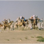
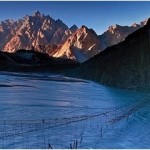
The geography of Pakistan is a profound blend of landscapes varying from plains to deserts, forests, hills, and plateaus ranging from the coastal areas of the Arabian Sea in the south to the mountains of the Karakoram range in the north.
Pakistan geologically overlaps both with the Indian and the Eurasian tectonic plates where its Sindh and Punjab provinces lie on the north-western corner of the Indian plate while Balochistan and most of the Khyber-Pakhtunkhwa lie within the Eurasian plate which mainly comprises the Iranian plateau, some parts of the Middle East and Central Asia. The Northern Areas and Azad Kashmir lie mainly in Central Asia along the edge of the Indian plate and hence are prone to violent earthquakes where the two tectonic plates collide.
Pakistan is nearly twice the size of California.
Pakistan is divided in three main geographic regions
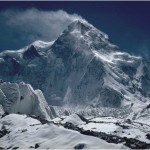
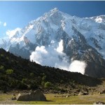
- Northern high lands (contain peaks like K2)
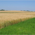
- Indus River Plains (one of the world’s most fertile plains )
- Balochistan Plateau (contains Gawadar Port , future economic corridor to South Asia)
Northern Highlands
The northern and western highlands of Pakistan contain the towering Karakoram and Pamir mountain ranges, which include some of the world’s highest peaks: K2 (28,250 ft; 8,611 m) and Nanga Parbat (26,660 ft; 8,126 m).
Indus River Plains
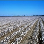
An expanse of alluvial plains, the Punjab and Sind, lie to the east. The 1,000-mile-long (1,609 km) Indus River and its tributaries flow through the country from the Kashmir region to the Arabian Sea.

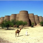
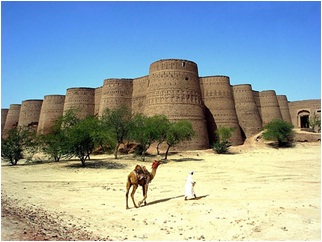
Balochistan Plateau
The Baluchistan Plateau lies to the west and the Thar desert lies in the east.